Multi-station Positioning system
In recent years, with the rapid development of the air transport industry, the number of airports in major cities and their surrounding areas has increased dramatically, high-density traffic has led to a reduction in the spacing between airports and their nearby aircraft, between aircraft and ground vehicles, running to invasion, scene conflicts, airport environmental impact is the launch, aviation safety, flight delay issues are becoming increasingly prominent. Urgent means of resolution were therefore needed.
ICAO requires the installation of a new generation of airport surveillance equipment at the airport to enable the aircraft to carry out a full range of automatic boot control from runways, taxiways, aprons and boarding gates at the airport, including a scene surveillance radar, ADS-B and multipoint positioning technology.
Scene monitoring radar terminology non-collaborative monitoring system, the system is affected by topography, weather, for large and medium-sized airports, single-weight coverage there is a blind area, itself no target recognition ability; ADS-B system is based on satellite navigation technology to achieve target positioning, it has satellite integrity and the need to retrofit old aircraft weaknesses, The application is limited, the multi-point positioning technology realizes the core technology of airport scene monitoring, uses the 1090MHz response signal emitted by the existing airborne transponder to realize the positioning of the aircraft, does not need to be modified for the existing monitoring equipment and airborne equipment, do not install other additional equipment on the aircraft.
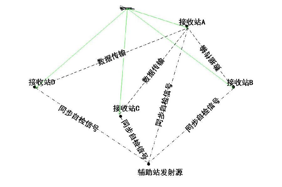
Multi-point positioning technology makes full use of the A/C/S mode answering signal of civil aviation aircraft standard configuration transponder, and uses multi-point receiving method to determine the position of aircraft or other moving target.
 Principle of multi-station positioning technology
Compared with scene surveillance radar, this technique is characterized by:
(1) Make full use of the existing on-board standard transponder, without the need to add other airborne navigation equipment to the aircraft to complete positioning monitoring;
(2) compatibleADS-B SimulatorTechnology
(3) a higher data rate;
(4) The key point is low cost;
(5) System monitoring without blind area, high positioning accuracy;
(6) The system has the ability of target recognition;
(7) The equipment size is small, the site configuration is flexible, the system monitoring coverage scope is strong adaptability.

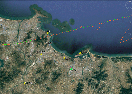
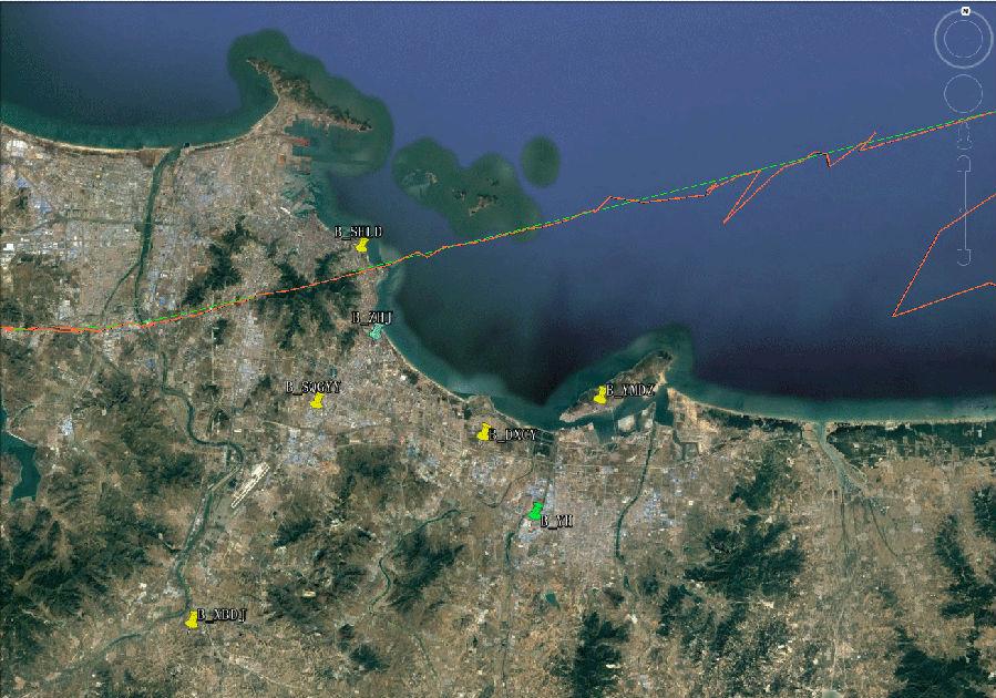
Preliminary use of four stations to realize the track location results of ADS-B signal
In the figure above, the green curve is the flight track data of ADS-B, whose data comes from the satellite navigation and positioning system, and the accuracy reaches the meter level. The red curve is the result of multi-station positioning, and its curve is in good agreement with the ADS-B curve, and the result is slightly worse at both ends of the curve, which is related to the filtering algorithm, the number of cloth stations and the mode of cloth station.
